Maps of Lantau Island
Physically the largest island in the Hong Kong Special Administrative Region, Lantau Island spans 147 square kilometers of diverse landscapes from bustling transportation hubs to serene mountain peaks. The island's mountainous geography originally meant settlements were concentrated along the coast, creating distinct communities with unique characters that persist today.
Modern development has transformed Lantau into Hong Kong's most strategically important island, hosting Hong Kong International Airport at Chek Lap Kok in the north, Hong Kong Disneyland Resort on the eastern shore, and the spiritual Ngong Ping village in the island's heart. The impressive Tsing Ma Bridge and related infrastructure connect Lantau seamlessly to Hong Kong Island and Kowloon, making all corners of the island easily accessible.
Navigation and Transportation Zones
The Hong Kong Government has implemented thoughtful planning to balance economic development with preservation of traditional rural lifestyles, particularly in the island's western regions. This creates distinct transportation zones with specific access rules that visitors should understand for effective trip planning.
Restricted Areas: Certain roads prohibit through traffic to protect residential areas. For example, direct vehicle access between Discovery Bay's residential development and Chek Lap Kok Airport is restricted, requiring alternative routing for private vehicles.
Country Parks: Large portions of Lantau are designated as Country Parks with strict environmental protections. These areas prohibit building development and restrict vehicle access, preserving the island's natural beauty for hiking, wildlife viewing, and outdoor recreation.
Key Landmarks and Districts
- Chek Lap Kok: Northern district hosting Hong Kong International Airport and related aviation infrastructure
- Penny's Bay: Eastern shore featuring Hong Kong Disneyland Resort and luxury hotel developments
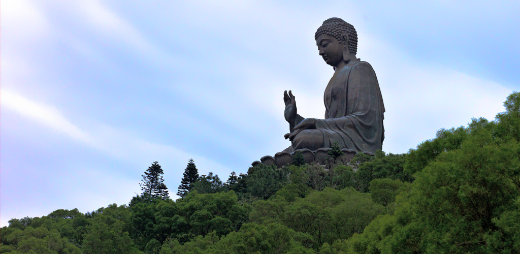
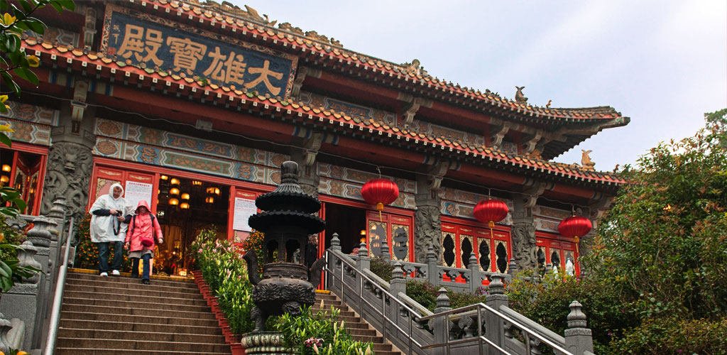
- Ngong Ping: Central plateau home to Tian Tan Buddha, Po Lin Monastery, and cable car terminus
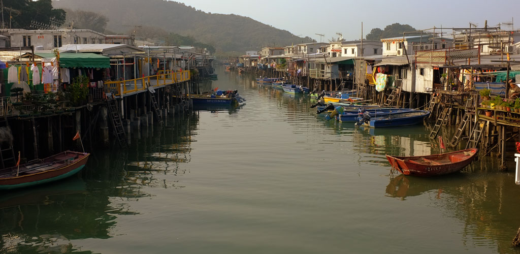
- Tai O: Western historic fishing village with traditional stilt houses and cultural heritage
- Discovery Bay: Eastern residential and resort community with ferry connections to Central Hong Kong
- Tung Chung: Northeastern new town with MTR terminus, shopping centers, and cable car base station
- Mui Wo: Eastern transportation hub with ferry terminal connecting to Central Hong Kong
Interactive Map
Use this detailed map to plan your Lantau Island adventure, identify transportation connections, and locate major attractions. The map shows current transportation routes, attraction locations, dining areas, and accommodation options across the island.
View Larger Map
Planning Your Visit
For comprehensive transportation information and route planning, visit our detailed transportation guide. To explore specific attractions and their exact locations, check our sightseeing guide or browse individual attraction pages for detailed directions and access information.
Pro Tip: Download offline maps before visiting remote areas of Lantau Island, as mobile coverage can be limited in mountainous Country Park regions. The Lantau Trail requires reliable navigation for safe hiking across the island's challenging terrain.